ChamJangal a hidden natural retreat along the Seymareh river
Cham-Jangal, a hidden natural retreat along the Seymareh river
TEHRAN – Tucked between oak-covered mountains and the scenic Seymareh River in western Iran, the village of Cham-Jangal offers a glimpse of a landscape where rugged mountains, lush woodlands and traditional rural life come together.
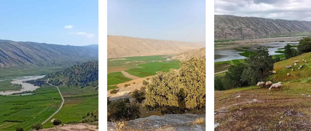
With its panoramic river views, agricultural heritage and a remarkable natural attraction that releases cool air even during the hottest months, the village has considerable potential to become a destination for nature lovers, although the loss of some of its historic pomegranate orchards to the rising waters of the Seymareh Dam reservoir has cast a shadow over its agricultural landscape.
Located in the Rudbar rural district of central Sirvan county, Ilam province, Cham-Jangal lies about 11 kilometers from Loomar, the county's main town. The village sits near the Seymareh River, surrounded by the mountains of Zoreh, Taghtuq and Lavala, whose slopes are covered in native oak forests.
Its elevated position provides sweeping views of the river and the surrounding countryside, making the village particularly appealing in spring, when the mountains turn green and the oak woodlands create a striking natural backdrop.
Speaking to ISNA news agency, Lida Mirzaei, the village head, the combination of mountainous terrain, woodland and proximity to the river gives Cham-Jangal distinctive potential for nature-based tourism.
Spring is among the best times to experience the area, when vegetation flourishes and the surrounding hills offer attractive landscapes for walking, photography and outdoor exploration.
A natural refuge from summer heat
Among the village's most distinctive attractions is a natural formation tucked inside a mountain. Resembling a small cave, the site releases remarkably cool air during summer, creating a natural refuge from the surrounding heat.
The unusual phenomenon has made the formation a popular gathering place for local residents and an attraction for visitors seeking cooler surroundings during the warmer months.
Together with the nearby oak forests and mountain scenery, the site could provide a foundation for developing small-scale nature tourism, particularly activities centered on hiking, landscape appreciation and visits to rural communities.
The surrounding mountains of Zoreh, Taghtuq and Lavala also offer opportunities for exploring the area's natural environment. Their woodland cover and elevated viewpoints provide a variety of landscapes within a relatively compact rural setting.
However, turning these natural assets into a sustainable tourism destination would require improvements to basic infrastructure and careful management of the surrounding environment.
Rural life shaped by farming and livestock
Despite its tourism potential, Cham-Jangal remains primarily an agricultural community.
According to the 2016 national census, the village had a population of 203 people living in 120 households. Of these, 71 households were permanent residents, while the remainder lived there seasonally.
Wheat, barley and rice are among its main agricultural products, while livestock raising has long been an important part of the local economy.
The village's agricultural land and access to water have traditionally supported farming and animal husbandry, shaping both the livelihoods and daily routines of its residents.
Pomegranate orchards were also once an important feature of the local agricultural landscape, contributing to household incomes and the village's rural character.
That agricultural heritage, however, has been affected by the Seymareh Dam project.
The cost of a rising reservoir
One of the most significant challenges facing Cham-Jangal is the impact of the rising water level in the Seymareh Dam reservoir, which has affected parts of the village's agricultural land.
Farzad Sharifi, director-general of Ilam's Cultural Heritage, Tourism and Handicrafts Department, said some of the village's pomegranate orchards had suffered damage after becoming exposed to flooding as the reservoir level rose.
The losses have affected not only farmers' incomes but also part of the village's agricultural capacity and natural landscape.
The situation highlights a challenge facing communities around major water infrastructure projects: balancing the benefits of development with the economic and environmental interests of people whose livelihoods depend on the land.
For Cham-Jangal, protecting the remaining agricultural resources and addressing the consequences of the reservoir's rising waters are important considerations in any long-term development strategy.
Infrastructure still needs attention
Basic infrastructure is another issue that needs to be addressed if the village is to attract more visitors.
Mirzaei said some of the village's streets have been asphalted, while others still require groundwork and paving. Certain roads also need their curbs and drainage arrangements completed.
She also pointed to the need for environmental improvements, including better-organized streets, green spaces, tree planting and the installation of appropriate urban and recreational furniture.
Such improvements, she said, could enhance the village's appearance, improve residents' quality of life and make it more attractive to visitors.
For a destination whose appeal lies largely in its natural setting and rural atmosphere, maintaining cleanliness and ensuring that development remains compatible with the village's character will be particularly important.
A wider landscape of history and nature
The broader Seymareh region also holds considerable historical significance, offering an additional dimension to travel in western Ilam.
The ancient city of Seymareh, located in the Seymareh Valley in what is now Darreh Shahr, is among the region's most important archaeological landscapes. Extending across approximately 120 hectares, it is widely regarded as one of the largest historical sites in western Iran.
The settlement is believed to have been the ancient Elamite city of Madakto, later known by other names, including Mehregan Kadak and Seymareh. Historical accounts describe it as a prosperous settlement with two fortresses before it was eventually abandoned, possibly following a powerful earthquake around a thousand years ago.
British explorer and archaeologist Henry Rawlinson visited the site in 1836, followed by French archaeologist Jacques de Morgan in 1891. Hungarian-British archaeologist Aurel Stein also explored the area in 1936.
AM
source: tehrantimes.com